Miles 2-15: The Golden Gate Bridge & GGNRA—the Flattest Flats, the Steepest Hills | Course Landmarks and Their History
The San Francisco Marathon course takes you on a counterclockwise 26.2 miles long tour along the Embarcadero of San Francisco, across the Golden Gate Bridge to Marin County, back to the Presidio and Golden Gate Park, to Haight Ashbury, the Mission, Potrero Hill, Dogpatch, and the finish line. We’ve introduced Mile 1 and The Embarcadero in the first post of this four-part series. Today, let’s learn about the Golden Gate National Recreation Area and the Golden Gate Bridge, landmarks that’ll accompany you for the next 14 miles.
Written by SFM Ambassador Scott Benbow and Pavlína Marek
Edited by Pavlína Marek
You will encounter your first uphill—and it’s a steep one—between Mile 2 and Mile 3 of the San Francisco Marathon. Fortunately, for a first hill, it’s relatively short. And, at the top, you’ll begin a much longer and gentler downhill back to a few more miles of flat terrain. You’ve entered the Golden Gate National Recreation Area (GGNRA), where you’ll be until mile 15.
The Golden Gate Bridge
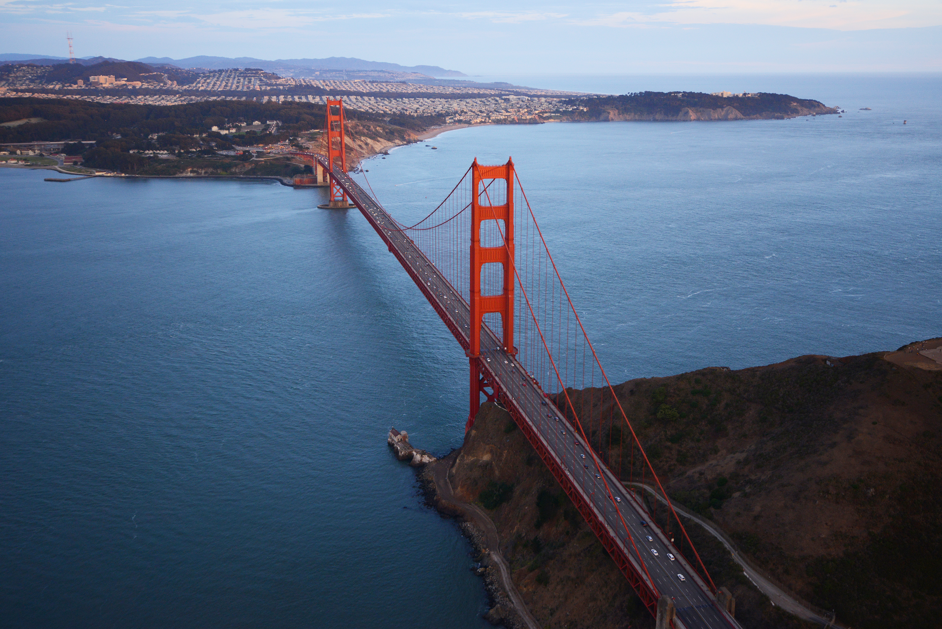
As a marathoner seeing the bridge from the 3-mile mark, your task is to get from sea level to the other side of the bridge and back again. Fortunately, you’ll either be looking at or running on the bridge for the next twelve miles.
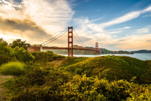
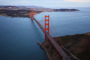
It’s hard not to look at the Golden Gate Bridge. Built in 1937, the bridge was originally supposed to be painted grey. However, the architect responsible for the color scheme preferred the color of the primer that was applied to protect the steel from rust. Therefore, instead of covering it with a more conventional grey, the primer color International Orange has been applied ever since.
Learn about the Golden Gate Bridge!![]()
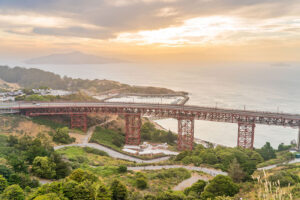
The climb from Crissy Field to the bridge is difficult and the climbing continues, at a less steep grade, as you approach the center of the Golden Gate Bridge. You’ll enter Marin County for a few steep downhill and uphill miles before returning to the bridge and eventually to San Francisco.
Visit Marin County!

How did the Marin Headlands come to be?
![]()
Go on a virtual run in Fort Baker!
![]()
It’s all downhill from Mile 14 to Mile 15 through a spectacular part of the Presidio from which you can see the Pacific Ocean to the west, the Marin Headlands to the north, and the western edge of San Francisco right in front of you.
At mile 15 after a very long downhill, you’re more than halfway to the finish line and you’ve tackled the most challenging uphills and downhills of the course. Now is a good time to focus on your pacing, fueling, and rehydrating. Soon you’ll be back in nature in Golden Gate Park which, ironically, is not part of the Golden Gate National Recreation Area.
The Golden Gate National Recreation Area
The GGNRA is a collection of national parks that includes the Presidio, Alcatraz, and other islands in the San Francisco Bay, the land northwest of the City all the way to Point Reyes, and, of course, the dramatic and iconic Golden Gate Bridge.
The name Golden Gate has a rich and often misinterpreted history. When early 16th-century European explorers Juan Rodriguez Cabrillo and Sir Francis Drake encamped and careened the Golden Hind in West Marin in June 1577, Karl the Fog, long before it was given its now-famous name, kept the strait obscured from their sight. The strait, formed during the last Ice Age, wouldn’t be seen by Europeans for another 200 years. (GoldenGate.org)
Many people think that the strait earned its name when gold was found in California. However, U.S. Army Captain John C. Fremont named it the “Chrysopylae” or “Golden Gate” two years before the discovery of gold in California, proclaiming that “it is a golden gate to trade with the Orient.”
10,000 Years Before Europeans
Of course, the strait’s history didn’t start with the arrival of Europeans. As you run in San Francisco and the Marin Headlands, it’s crucial to remember that only six generations ago, you’d see a completely different society.
The Spanish settled the area in 1776. “By 1810, introduced diseases, forced labor, and efforts to indoctrinate the indigenous peoples into an alien society and religion led to a tragic destruction of the way of life of Ohlones and Coast Miwoks.” (Golden Gate NPS) For 200 years, until 1978, the American Indians didn’t have the right to freely practice their religion and were prosecuted and killed for doing so. Today, paths for reconnection are finally opening again.